Mary and I plan to start hiking the Appalachian Trail in March. But, how do we get to the southern terminus? With hundreds of souls doing this every spring, the way is pretty well marked. The Thru-Hiker's Companion offers lots of guidance. Here's what we've found so far:
There are several options and decisions to consider.Will a friend or family member get us there? Or will we fly into Atlanta? Take a bus, or train? When will we get to the area, and where will we spend the first night? Will we hike the approach trail from Amicalola State Park, or get someone to get us up the forest roads to a spot close to the top of Springer Mountain?
Friday, September 30, 2011
Sunday, September 11, 2011
A Backpacking Camera
 |
| No, this ain't it ... |
Now, to be fair, that's not a bad camera, I use it a lot, and it would be a rational choice not to add the weight of another camera on a long hike. But, to try and capture the essence of the trail and the people hiking it, I want a camera that allows more creative control, and that is capable of producing high quality imagery. Heck, I may try and get a coffee table book outta it ...
Labels:
backpacking,
Camera,
Canon S95,
Droid,
electronics,
FujiFilm x-10,
Fujifilm X100,
Micro four thirds,
Olympus E-P3,
Olympus ZX-1,
Panasonic Lumix DMC-GF3,
Panasonic LX5,
photography,
Smart Phone,
Sony NEX,
X100
Friday, September 9, 2011
When to Start an AT Thru Hike
Having decided to tackle the Appalachian Trail, we needed to decide when we wanted to start. We found that decision was affected by the time of year and seasons we wanted to hike, and our tolerance for cold, crowds, and black flies.
Labels:
Appalachian Trail,
backpacking,
camping,
nobo,
northbound,
Sobo,
Southbound,
Springer Mountain
Thursday, September 1, 2011
Posting Waypoints Along the Way
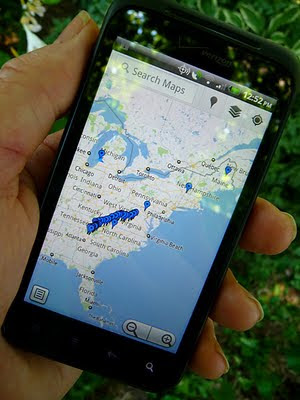
 I thought it would be cool if I could put a map on here that showed my progress as I hiked the Appalachian Trail. I started looking to find a way to create a map that could be embedded in the blog, and update it by placing a waypoint at my current position each day, using my Android smart phone.
Labels:
Android,
Appalachian Trail,
backpacking,
Droid,
electronic navigation,
Google Maps,
GPS,
My Maps,
My Places,
My Tracks,
Smart Phone
Subscribe to:
Posts (Atom)
